Sentosa is Singapore’s premier resort destination for locals and tourists alike.
Research showed that visitors had limited understanding of the island as a whole, beyond the attractions they had planned to see. To mitigate this, Applied set out to systematically increase awareness of the resort’s offerings.
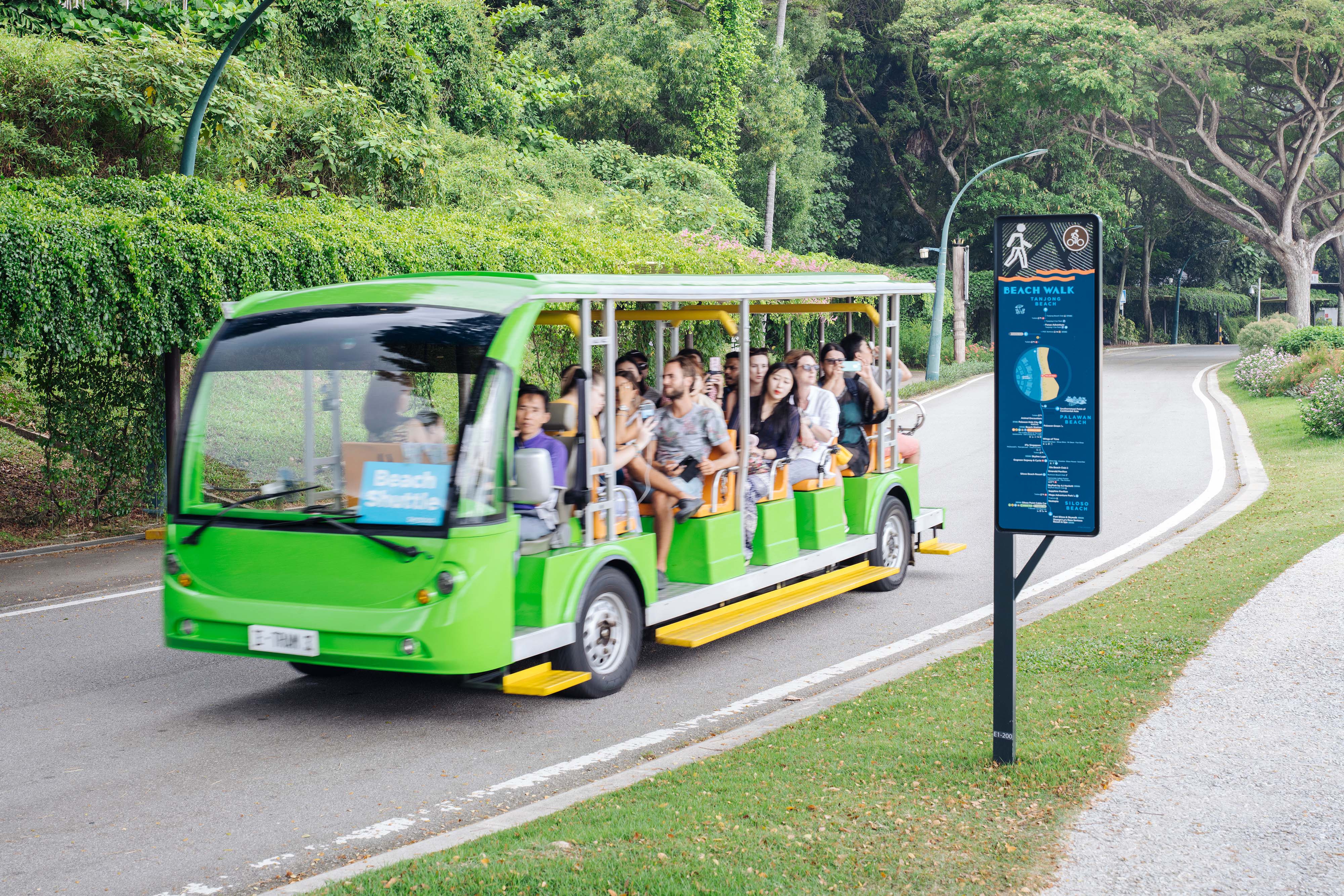
In accordance with the Sentosa Master Plan, an extensive wayfinding system has been implemented to integrate vehicular, public transport, pedestrian, and cycling movement. Beach and trail signs promote walking and cycling, raising awareness and encouraging discovery of every part of the island.
20 million annual visitors
Bronze award 2020 International Institute for Information Design


Sentosa’s attractions include three beaches, sixteen hotels, Resorts World Sentosa with Universal Studios theme park, heritage sites such as Fort Siloso, two golf courses, extreme sports, jungle trails, and a yachting marina. Research revealed a general perception of disconnect between destinations on the island. This discouraged visitors from fully exploring.

Uncovering issues large and small, and developing solutions – best achieved with the team that knows the site the best.

Highlighting three key walking routes to connect the Island, new named zones to simplify wayfinding for both pedestrians and vehicular drivers, and changing two Express Station names to be more intuitive and memorable.

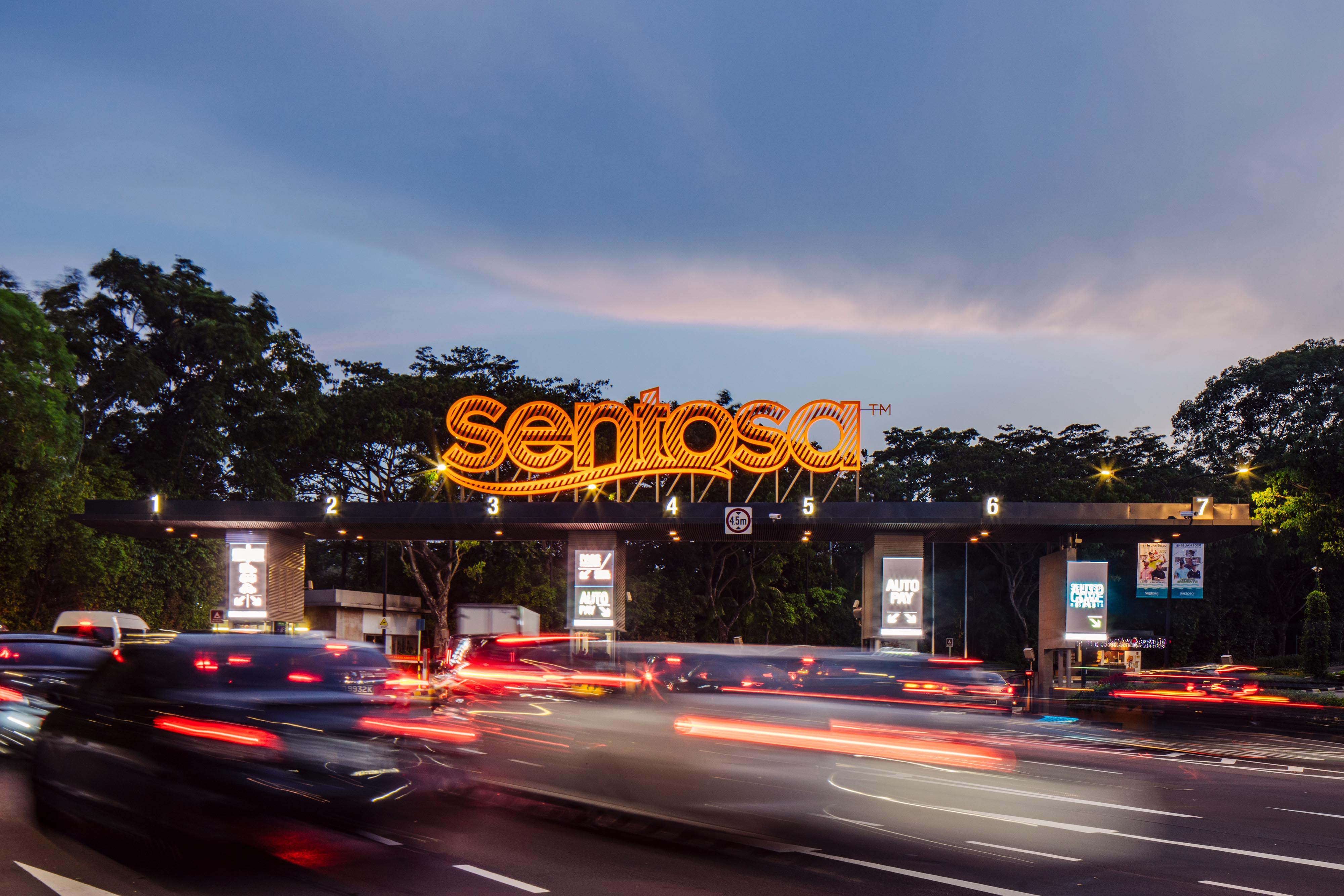
Overcrowding of the connecting monorail made Sentosa Development Corporation look for new ways to encourage entry into the island by alternative means such as bus or walking along the boardwalk. SDC were also facing competing demands from stakeholders, whilst managing an ad-hoc sign system that had become ineffective.


The new system integrates with diverse environments in a more considered way, yet stands out when it needs to. Simplified linear diagrams with walking times, nearby amenities, and attractions, encourages exploration along the routes. This minimised the need for traditional directional lists and presented a more engaging system.


A comprehensive wayfinding system from vehicular, pedestrian, to cycle wayfinding, as well as code signage, trail, interpretive, digital, and temporary information.
Complex and diverse assets
Sentosa’s attractions include three beaches, sixteen hotels, Resorts World Sentosa with Universal Studios theme park, heritage sites such as Fort Siloso, two golf courses, extreme sports, jungle trails, and a yachting marina. Research revealed a general perception of disconnect between destinations on the island. This discouraged visitors from fully exploring.

Planning together
Uncovering issues large and small, and developing solutions – best achieved with the team that knows the site the best.
Strategic recommendations
Highlighting three key walking routes to connect the Island, new named zones to simplify wayfinding for both pedestrians and vehicular drivers, and changing two Express Station names to be more intuitive and memorable.


Solution from arrival to departure
Overcrowding of the connecting monorail made Sentosa Development Corporation look for new ways to encourage entry into the island by alternative means such as bus or walking along the boardwalk. SDC were also facing competing demands from stakeholders, whilst managing an ad-hoc sign system that had become ineffective.

The new system integrates with diverse environments in a more considered way, yet stands out when it needs to. Simplified linear diagrams with walking times, nearby amenities, and attractions, encourages exploration along the routes. This minimised the need for traditional directional lists and presented a more engaging system.

With its natural palette, the map design compliments the tropical environment, while other types of signage reflect a more colourful and vibrant tone in keeping with Sentosa’s brand identity as the State of Fun.
A comprehensive wayfinding system from vehicular, pedestrian, to cycle wayfinding, as well as code signage, trail, interpretive, digital, and temporary information.