
Heathrow Airport is one of the world’s most challenging and complex environments. Research shows that a large proportion of 80 million annual passengers suffer time pressure and uncertainty – leading to a stressful experience.
Mapping is a tool that can explain and improve awareness – reducing stress.
Heathrow had a legacy of multiple different mapping approaches, none of them designed specifically for the inexperienced traveller.
The hub-map project consolidated the design into a usability tested standard and applied this physically and digitally in terminals as well as online and on mobiles.
80.1 million annual passengers
219,458 daily passengers
1,227 hectares site coverage
Wayfinding and effective mapping are paramount in any airport environment, which is often highly stressful. Heathrow’s maps lacked consistency, legibility and accessibility, and were out of date and inaccurate. Solving the problem started with a comprehensive surveying exercise combined with a rigorous design exploration and testing effort. This resulted in a new mapping design standard. This established a core set of design elements, colour choices and representations. The system has not changed since introduction.

A data-driven map system with a central database was built to ensure the integrity of information and to make the management of the system as simple and robust as possible. The centralised system allowed for the output of maps in different formats, for signs, print materials, web and mobile.


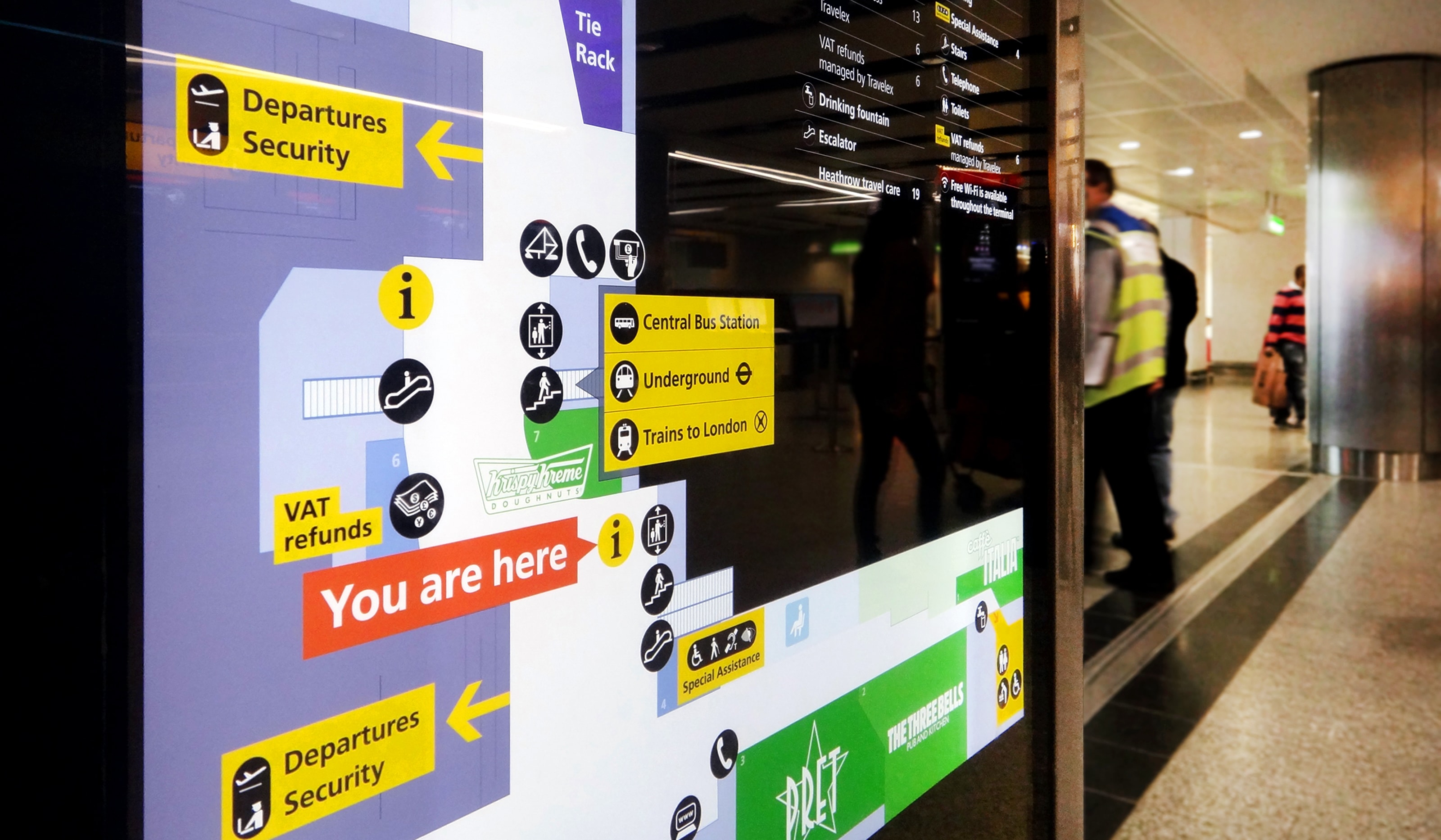
Terminal 4 maps demonstrate the graphically distinct outputs obtained from a single mapping database. Map-based signs are on a black base. Printed maps on a white base. Base layer data is consistent across both outputs. Overlay information and map crops vary. This is in response to how and where each of these maps are used by travellers.

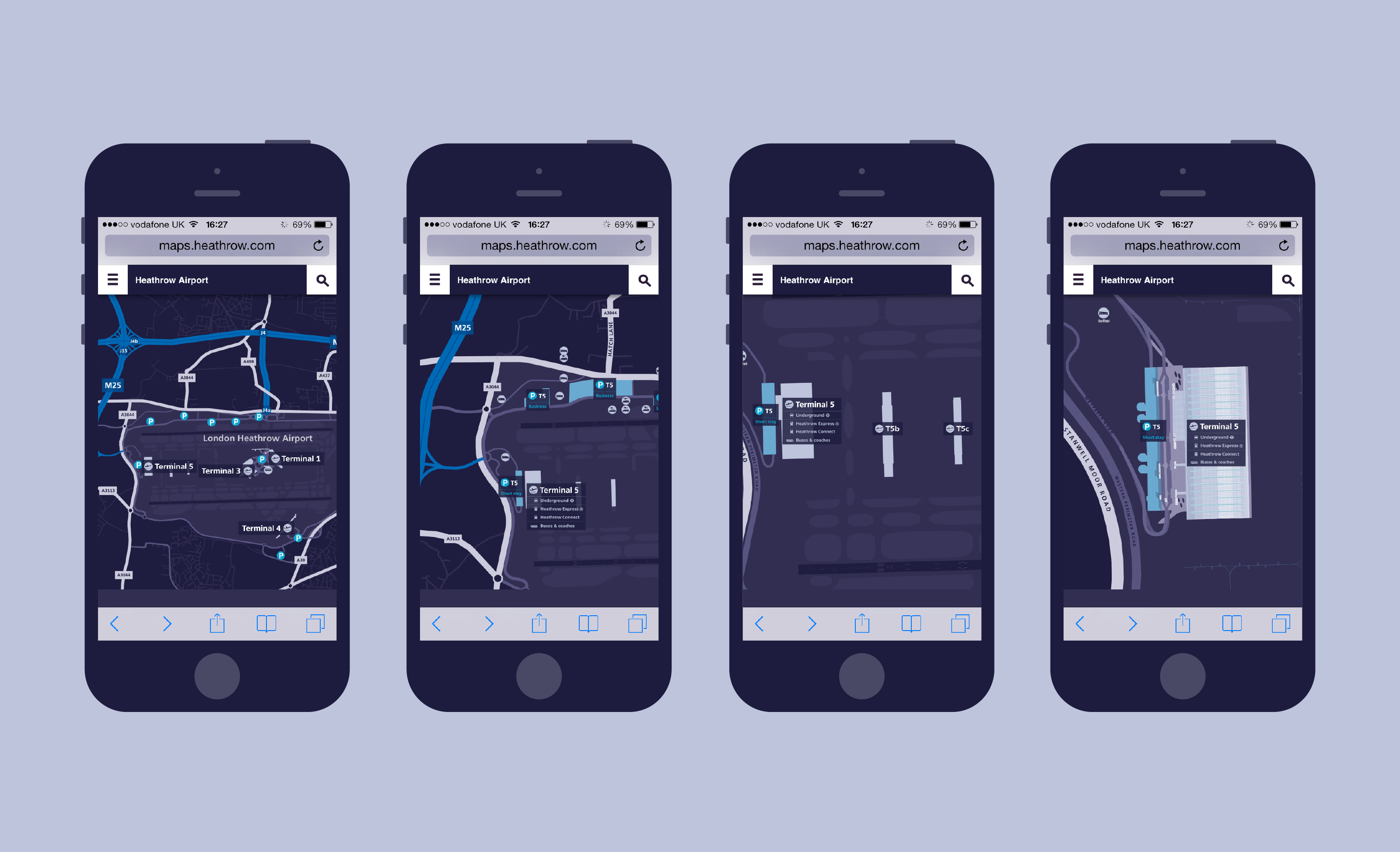
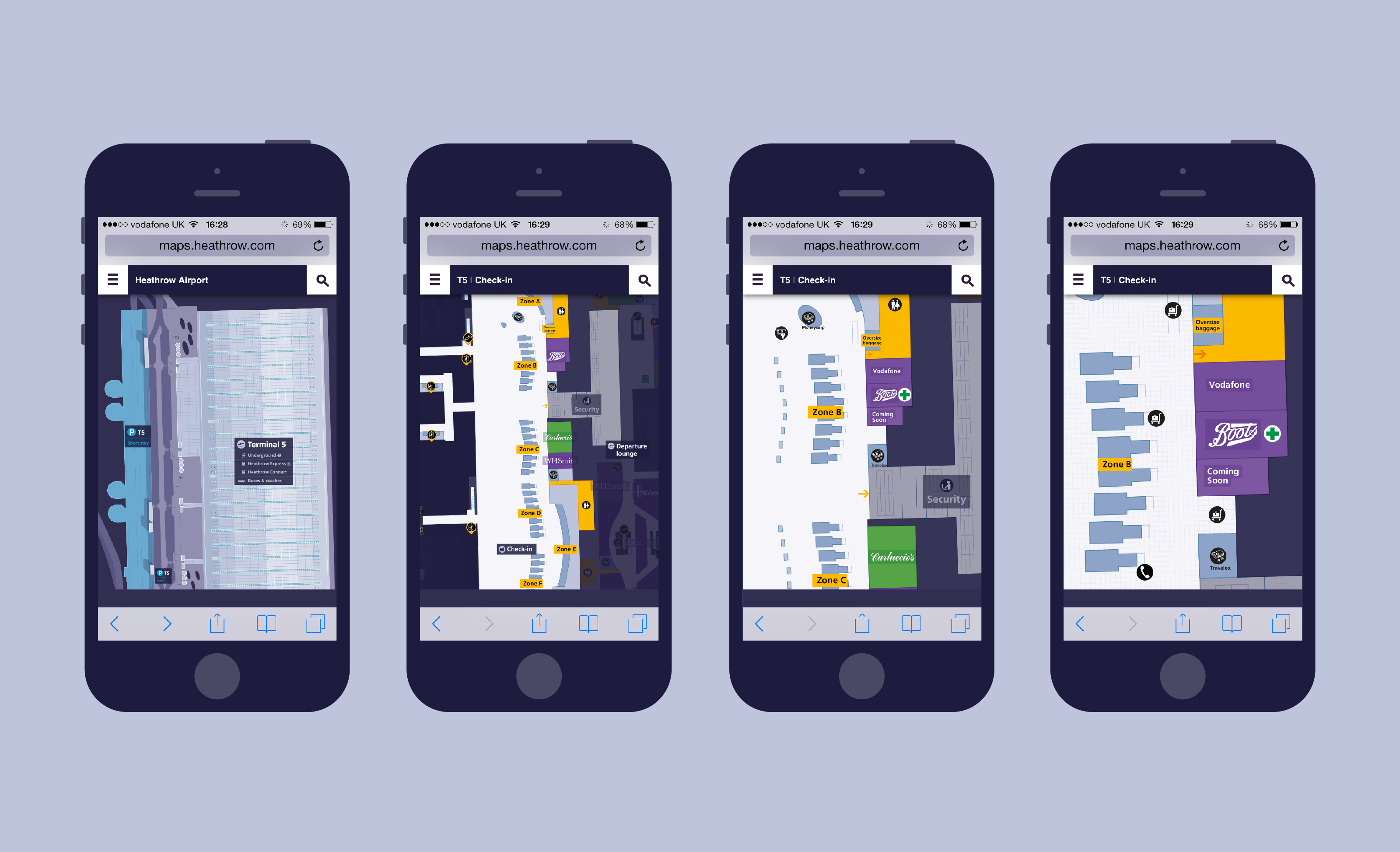
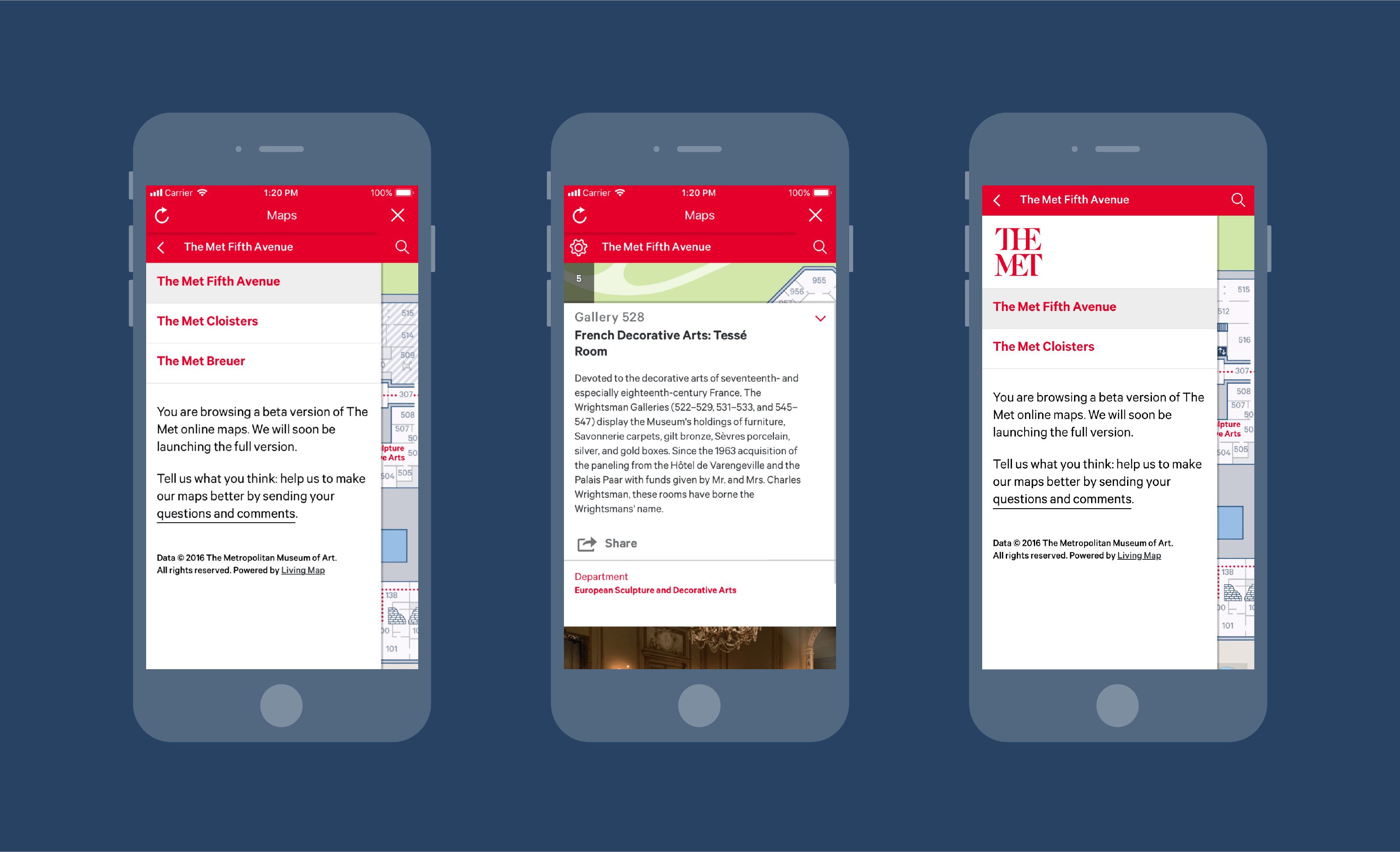
Drawing from existing technologies and examples of digital wayfinding, a map-based interface was developed to support travellers along their journey, providing them with information about journey planning, flights, airport services and the retail experience in real time.
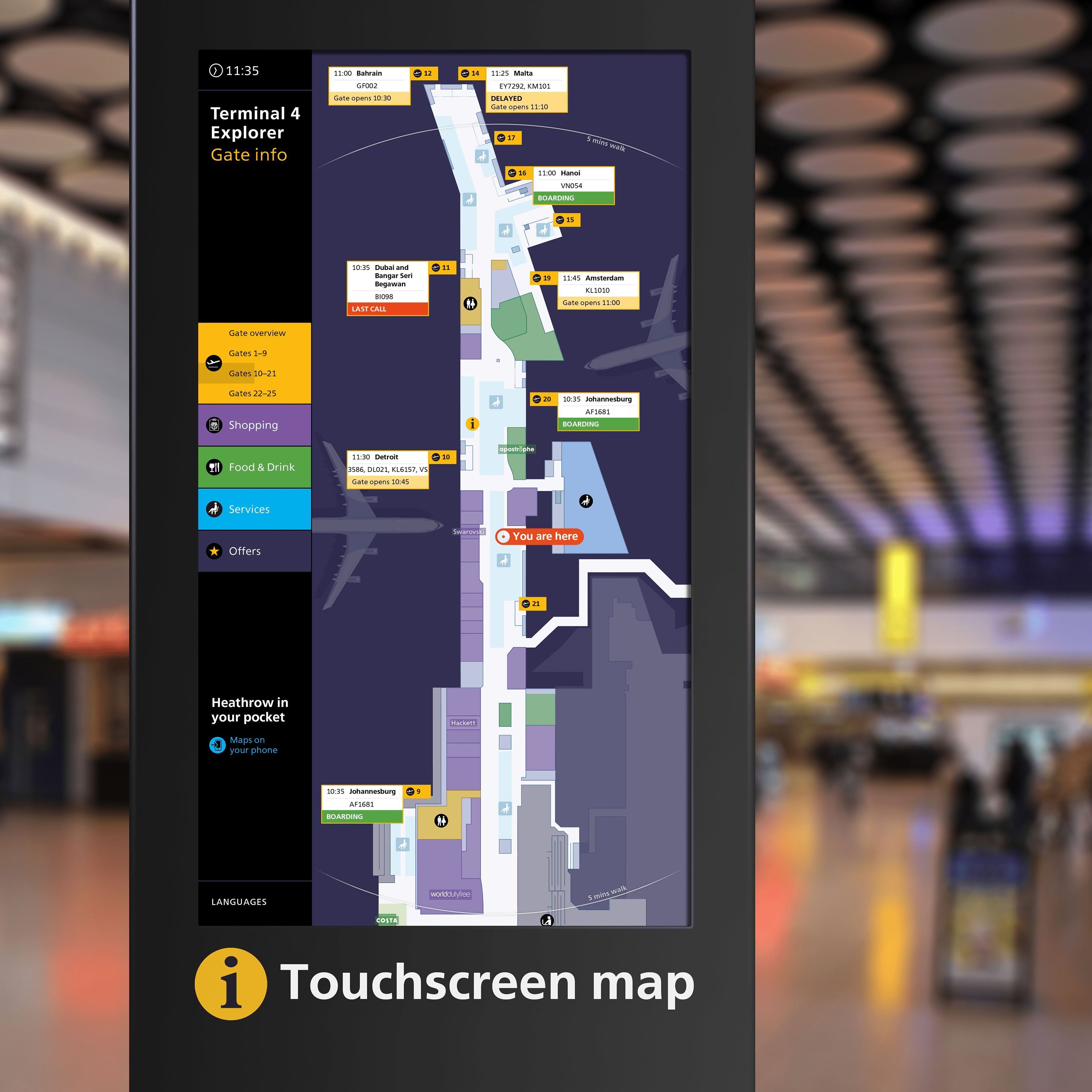
The digital mapping interface was designed to adapt to interactive screens, providing travellers with an overview of the terminal, and allowing them to explore retail and services.
Mapping challenge
Wayfinding and effective mapping are paramount in any airport environment, which is often highly stressful. Heathrow’s maps lacked consistency, legibility and accessibility, and were out of date and inaccurate. Solving the problem started with a comprehensive surveying exercise combined with a rigorous design exploration and testing effort. This resulted in a new mapping design standard. This established a core set of design elements, colour choices and representations. The system has not changed since introduction.
A centrally-managed system
A data-driven map system with a central database was built to ensure the integrity of information and to make the management of the system as simple and robust as possible. The centralised system allowed for the output of maps in different formats, for signs, print materials, web and mobile.
One system, multiple outputs
Terminal 4 maps demonstrate the graphically distinct outputs obtained from a single mapping database. Map-based signs are on a black base. Printed maps on a white base. Base layer data is consistent across both outputs. Overlay information and map crops vary. This is in response to how and where each of these maps are used by travellers.
Digital innovation
Drawing from existing technologies and examples of digital wayfinding, a map-based interface was developed to support travellers along their journey, providing them with information about journey planning, flights, airport services and the retail experience in real time.
Real-time information
The digital mapping interface was designed to adapt to interactive screens, providing travellers with an overview of the terminal, and allowing them to explore retail and services.